Women’s Christian College
A govt. Aided College
NAAC accredited with "B++" grade
Affiliated to the University of Calcutta
AISHE CODE : C11920
Estd. 19th July, 1945

Latest News
A govt. Aided College
NAAC accredited with "B++" grade
Affiliated to the University of Calcutta
AISHE CODE : C11920
Estd. 19th July, 1945
The Department of Geography is one of the oldest departments of the college. It is a practical based department with both Honours and General courses to offer. It is a complete department with four highly qualified permanent full-time faculty members, one Laboratory Instructor(retired on 2023) and one Laboratory Attendant. It is one of the departments with a high student enrolment, commendable success rate in University examinations, a considerable progression to higher education and vocational placements. Many of them have qualified UGC-NET and are well placed in academic field.
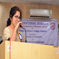
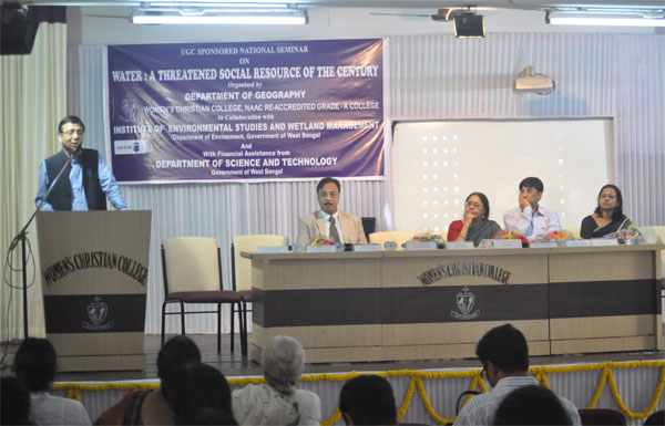
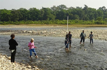
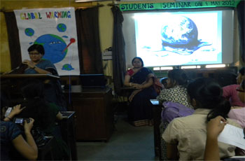
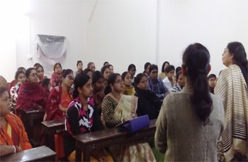
The Department organizes annual excursions and day-long trips for Honours and General students, departmental students’ seminars, workshops and special invited lectures. Periodic assessment of students is done regularly by conducting class tests. The Faculty members offer special guidance to both strong and weak learners and regular informal counselling. The students of the department are also associated with the various activities of the different cells of the college like the Eco Club, NSS and Women’s Study Cell units. The students of the Department are associated with the publication of the departmental magazine called “Bhugoliyo” and also the annual Wall Magazine. Parent-Teacher meetings are held annually to interact with the parents and to inform them about their wards’ progress.
The Department of Geography is well-equipped with classrooms with audio–visual back-up, an integrated laboratory with tracing facilities, soil test and GIS mapping with adequate number of computers and printers. The departmental assets include a rich collection of necessary maps, rock specimens, instruments for surveying and an adequate number of aerial photographs, satellite imageries as well as other equipment. Of special mention is the Departmental Seminar Library with a rich collection of Text as well as Reference books for students to consult.
The students of the Department are also enrolled for an optional six month certificate course on QGIS conducted by Webel-Opsis Ltd. as part of the departmental endeavour for future placement and career counselling for the students of the Department. Ex and present student interactions are also organized for the academic and career benefits of the outgoing students.
The strength of the Department lies in a healthy Teacher-student relationship, dedicated faculty and a spirit of cooperation among the staff members (both Teaching and Non-teaching) and the students.
| Sl No | Title | Result View |
|---|


| Sl No | Title | Notice View |
|---|
Executive summary:
The livelihood in Sunderbans is very much controlled by the tidal oscillation of the rivers. The reclaimed parts are the most vulnerable parts as susceptible to various types of hazards. Natural calamities from climatic hazards and tectonic hazards are common and inevitable also and the nature might also overcome it in its very own way but hazards caused by manmade structure bring disasters. Thus income shocks are very frequent in this part rendering the population highly vulnerable.
Reclamation of islands from inundation twice a day for last two hundred years has left the region with such a level that the beds of the rivers had raised enough due to siltation and at the time of high tide rivers flow at a higher level than the villages. During cyclonic upsurges the water level goes further above the crest of the embankment. As a result disasters like cyclone usually result into inundation of the villages, loss of life and livestock, loss of property etc. On the other hand the forested islands where human intervention is yet to start are least affected during cyclonic disaster. Even during ‘aila’, in 2009 when the wave achieved a height of three metres, there was no record of any loss of tiger population as the forested areas have already attained a height due to regular deposition of silt in course of time. But loss of life, livestock, agricultural crops, fishes, and property was huge in the reclaimed part. Embankments were initially erected in purview of protecting the land from saline water intrusion but at present the height of the embankment has fallen short. Moreover, the reversal of gradient causes stagnation of water on floodplains for a considerable period till evaporation or infiltration.
The Sunderbans Affairs Department and the Forest Department are the two departments that have the broadest administrative influence over the region. The irrigation department looks after the age old embankments. In West Bengal ‘Disaster Management’ is a reactive programme, it starts operating after the event strikes. The National Disaster Management Authority in its flood management policy of 2008 declared that the focus should be shifted from erstwhile relief centric post-event response to pro-active response encompassing prevention, mitigation and preparedness.[1] The Inter Governmental Panel on Climate Change in its fourth assessment report predicted that there will be more hydro-meteorological events severely affecting lives and livelihoods of the people living in Indian subcontinent, so preparedness and mitigation should be strengthened.
The society in Sunderbans is agrarian with a practice of mono cropping. Whatever be the intensity of disaster the agricultural sector suddenly gets disrupted. The 20th century has recorded 44 tropical cyclones striking the coast of Bay of Bengal. ‘Aila’ in 2009 had collapsed the entire ecological system of Sunderbans as it had surpassed all previous records in terms of damage and economic loss. Three years have already passed but the recovery is yet to achieve. The villagers did not take the risk of cultivation for the first two seasons after ‘aila’, now crops has been initiated after two rainy seasons but the yield is very poor in terms of quality and quantity as salinity in soil is high enough. Many families are still living under the sky as they could not even manage to rebuild their shelter.
The sub-aqueous delta has a long depositional history of 70 million years. Fluvial and marine land building processes operate here with cyclical advancement and retreat of the sea during the past geological ages. The main economic activity of the region is paddy cultivation and it became possible due to the earthen embankments that keep the brackish water away. So failure of age old embankments, which is very common in the region, may sometimes cause devastation in livelihood. So a proper management plan has to be formulated for sustenance of embankments as well as population. The sediments of the region that got deposited are not fully consolidated and the region is therefore gradually subsiding. Overlying concrete structure of embankment may result into collapse of the entire structure. So it is the job of the engineers, the geologists, the soil scientists to prescribe such a structure that would sustain.
A number of recent media reports have given vivid accounts of the current and potential impacts of ‘aila’. The government has expressed opinion for strengthening the embankment by concrete material but this decision has welcomed many controversies from various spheres. But everybody has come to a unanimous opinion that around 5 million population in Sunderbans cannot be displaced from their indigenous habitat rather initiatives are to be taken so that the possibilities of hazards can be minimized.
The study focuses in particular on the socio economic problems of Sunderbans region in relation to the embankments. The report highlights the dependency of the inhabitants on agriculture and how they treat the embankments as their lifeline. It tries to point out how adversely the population of Sunderbans be affected whenever there is a failure of embankment. It again tries to establish the demand of the local inhabitants for strengthening the embankment and its proper maintenance.